×
About this Map
Author: Merensky, Alexander, 1837-1918
Author: Sulzer, J.
Date: 1875
Short Title Original map of the Transvaal or South-African Republic
Publisher: A. Merensky
Publisher Location: Berlin
Type: Separate Map
Obj Height: 46cm
Obj Width: 46cm
Scale: 1 1,800,000
Note: "A very rare and historically important map – the first comprehensive, accurate general map of the Transvaal, issued shortly before the First Boer War (1880-1), by the missionary-cartographer Alexander Marensky... an intrepid German missionary-cartographer who tirelessly surveyed the bushveld, while searching out the best sources from other mapmakers. The region was then a wild and volatile frontier, the control of which was actively contested between the Afrikaner settlers, the various native nations and the covetous British colonists and officials who were progressively moving in from the Cape. Recent finds of gold and diamonds, which are prominently noted on the map, had suddenly brought this land to global attention. These factors would soon lead to the First Boer War (1880-1), followed by the explosive population and economic growth of the Transvaal. The present 1875 map by Merensky follows the 1868 map of the Transvaal he made in conjunction with Friedrich Jeppe. While the earlier map represented a major advancement, it contained many serious inaccuracies and blank spaces that were corrected and filled in by the present production. The map shows the Transvaal with very expansive borders, such that it designates many of the regions that were disputed with neighbouring jurisdictions as decisively being a part of the ZAR. For instance, the border with Portuguese East Africa (Mozambique) cuts far to the east of the true line, only a short distance from the colonial capital of Lourenço Marques (Maputo). Also Swaziland (in reality then, as now, a fully independent kingdom) is shown to be a part of the ZAR, as are the southern districts of Utrecht and Luneberg, which were really a part of Natal. Within the Transvaal, all districts are labeled, while symbols, identified in the legend below the title, designate all towns; European farms and small villages; missions; native villages, as well fountains or pits (sources of water). Pretoria, the capital of the ZAR, graces the centre of the map, while a series of roads and bush tracks connect it to an archipelago of fledgling towns and settlements. Of great importance, the map also labels the ‘Boundary of the Tsetse Fly’, designated by a green line. This disease-carrying insect, the scourge of Europeans in Sub-Saharan Africa, occupied the lowland areas, although not the high plateau of the Transvaal. While Europeans could live in relative health in the fly-free zones, the lands beyond the line represented omnipresent danger. The map predates by over a decade the explosive growth experienced by the Transvaal following the discovery of massive gold deposits along the Wittwatersrand Ridge in 1886, located to the southwest of Pretoria (Johannesburg was founded that year). That being said, the map provides a wealth of information on the early discoveries of gold and diamonds in the region, which are noted throughout. For instance the map labels the ‘Diamondfields’ (the world’s largest) near Kimberly, West Cape, the ‘Goldfield’ near Lydenburg in the northeast and ‘Buttons Goldfield’ near Marabasdorp, amongst many others." (Alex Johnson, 2015) “As a researcher Merensky was particularly interested in geography and made two significant contributions in that field. Assisted by Carl Mauch, the explorer, and Friedrich Jeppe, the postmaster-general and cartographer, he in 1868 published a map which is a relatively comprehensive survey of the Transvaal. In 1875 he published in Germany a considerably improved map of the Transvaal Republic; for a long time it was considered the best cartographical survey of this area.” (Dictionary of South African Biography). Outline color map of Transvaal Republic with surrounding territories. Shows principal places or districts, villages, missionary stations, abandoned stations, kraals, farms, forest, Tsetse fly boundaries, mining fields, etc. Map indicates British and Portuguese dominions. Relief shown by hachures.
Country: South Africa
Country: Transvaal Republic
Full Title: Original map of the Transvaal or South-African Republic, including the gold and diamondfields. From the best sources and documents, especially from sourveys by Mr. Mauch, Baines, Mohr, and others, combined with the results of hisown explorations by A. Merensky, Superintendent of the Berlin missions in Transvaal. Berlin & Botsabelo, 1875. Selbstverlag des Verfassers. Zu beziehen vom Missionshaus, Berlin, Friedensstr. 4. Engraved by J. Sulzer. Berlin.
List No: 11205.000
Engraver or Printer: Mauch, Carl Gottlieb, 1837-1875
Engraver or Printer: Baines, Thomas, 1820-1875.
Engraver or Printer: Mohr, Eduard, 1828-1876.
Publication Author: Merensky, Alexander, 1837-1918
Publication Author: Sulzer, J.
Image No: 11205000.jp2
Download 1
Full Image Download in JP2 Format
Download 2
GeoViewer for JP2 and SID files
Authors Merensky, Alexander, 1837-1918; Sulzer, J.
Summary The map titled "Original Map of the Transvaal or South-African Republic, including the Gold and Diamondfields" was created by Alexander Merensky and engraved by J. Sulzer in 1875. It measures 46 cm by 46 cm. This important cartographic work represents the Transvaal Republic during a period of significant geopolitical tension and economic interest, just before the First Boer War (1880-1881).
Composition and Medium:
The map is an engraved outline colored map that details the Transvaal Republic and its surrounding territories. The cartography is precise, showcasing relief through hachures, and it uses symbols to indicate various geographical and man-made features. The map is executed with great detail, reflecting the careful work of a missionary-cartographer familiar with the area.
Style and Notable Features:
The map is notable for its meticulous labeling of districts, towns, European farms, small villages, mission stations, native villages, and water sources. Of particular interest is the designation of the "Boundary of the Tsetse Fly" with a green line, indicating areas of potential danger due to the presence of this disease-carrying insect. The map also prominently marks locations of significant mineral wealth, such as gold and diamond fields, which were crucial to the region's economy and the interests of colonial powers.
Subject Matter:
The subject matter focuses on the geographical and political landscape of the Transvaal Republic during a time of rapid change. It marks the borders of the Republic expansively, including disputed regions with British and Portuguese dominions. Notably, it includes Swaziland and other areas that were not officially part of the Transvaal, highlighting the contested nature of these territories.
Cultural and Historical Context:
During this period, the Transvaal was a volatile frontier contested by Afrikaner settlers, native nations, and British colonial interests. The recent discovery of gold and diamonds brought international attention to the area, setting the stage for future conflicts and economic development. This map serves as a historical document reflecting the geopolitical aspirations and conflicts of the time.
Significance:
This map by Merensky is considered the first comprehensive and accurate general map of the Transvaal. It improved upon previous maps by correcting inaccuracies and adding detail. It was published shortly before the First Boer War, a conflict sparked by the imperial ambitions of the British and the strategic importance of the region's mineral resources.
Publications:
The map is part of a separate map publication and is listed under "List No 11205.000" and "Pub List No 11205.000". It serves as a significant reference for understanding the historical geography of the Transvaal and the broader South African region during the late 19th century.
In summary, this work is a critical historical artifact that provides insights into the geographical, political, and economic landscape of the Transvaal during a pivotal period in South African history.
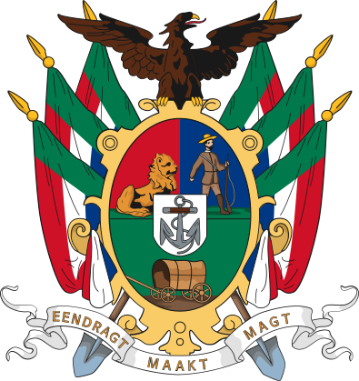 1857 Zuid Afrikaansche Republiek (Transvaal) Map